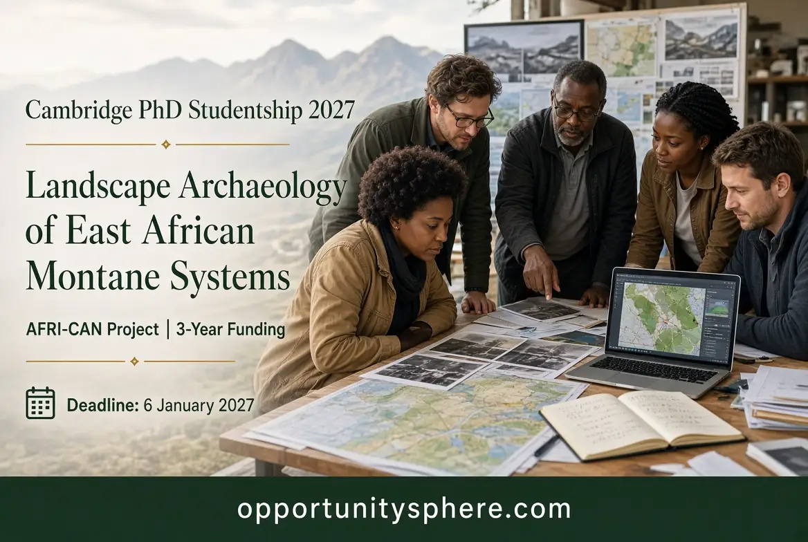
PhD Studentship in the Landscape Archaeology of East African Montane Systems – 2027
Offered by University of Cambridge – Department of Archaeology
Location
United Kingdom
Funding
Partially Funded
Study level
PhD
Field of study
Arts & Humanities, Environmental Sciences, Social Sciences
Application deadline
January 6, 2027
About This PhD and Research Opportunity
The University of Cambridge, United Kingdom, is inviting applications for a three-year PhD studentship in the Landscape Archaeology of East African Montane Systems. The successful candidate will join the University's Department of Archaeology and become part of the AFRI-CAN project, an interdisciplinary research initiative investigating how human communities and mountain ecosystems have influenced one another across East Africa.
The studentship will begin in October 2027 and is funded through an European Research Council (ERC) Synergy Grant (Grant No. 101224449). The doctoral researcher will be based at the McDonald Institute for Archaeological Research, University of Cambridge, and will work under the co-supervision of Professor Paul Lane and Dr Stefania Merlo. The wider project is led by Professor Rob Marchant of the University of York and brings together researchers with expertise in archaeology, ecology, environmental science, geography, anthropology, history and climate modelling.
The research addresses an important question: how have people used, managed and changed East Africa's mountain environments over thousands of years, and what can the historical record tell us about the future of these landscapes?
Mountain ecosystems provide important resources and environmental services, but they are also affected by human settlement, agriculture, livestock keeping, forest use, changing economic activities and climate conditions. Understanding these interactions requires evidence from both the natural environment and the history of human activity.
The AFRI-CAN project therefore examines mountain landscapes as mountain socioecological systems: interconnected systems in which communities, ecosystems, natural resources and environmental processes influence one another.
The PhD researcher will contribute to the project's historical research by reconstructing past land use and land-cover change, with particular attention to forestry and forest management.
1. Understanding the AFRI-CAN research project
AFRI-CAN is organised around four connected work packages that examine mountain socioecological systems across different periods and from different disciplinary perspectives.
Work Package 1 – The Past (approximately 6,000 years ago to the present)
This work package investigates how human communities and mountain ecosystems have interacted over the long term. It draws on archaeology, palaeoecology, anthropology, history, ecosystem modelling and climate modelling to understand changes in settlement, resource use, vegetation and environmental conditions.
The advertised PhD studentship is located within this work package. The researcher will help assemble and interpret historical and archaeological evidence to reconstruct changes in land use and land cover across selected East African mountain study sites.
Work Package 2 – The Present (1970–2025)
This part of the project examines more recent interactions between communities and mountain ecosystems. It brings together anthropology, history, ecology, ecological economics, soil science, remote sensing, ecosystem and climate modelling, and participatory research.
The purpose is to understand the more recent drivers of environmental and social change and how communities currently depend on and manage mountain resources.
Work Package 3 – The Future
Using evidence from the historical and contemporary work packages, this part develops future scenarios for mountain landscapes. The project considers possible pathways for 2030, 2063 and 2100, working with different stakeholders to explore how these environments and the communities that depend on them may respond to future challenges.
Work Package 4 – Wider application
The fourth work package applies the project's findings to other mountain socioecological systems in Africa and globally. It aims to develop scenarios and pathways that can inform decision-making about the opportunities and challenges facing mountain environments.
This wider structure is important because the PhD is not an isolated archaeological investigation. Its findings will contribute to a larger research programme connecting historical evidence with present-day environmental conditions and future land-use planning.
2. What the PhD researcher will investigate
The successful candidate will focus on developing detailed historical Land Use and Land Cover (LULC) maps across selected East African mountain study sites.
Land use describes how people use an area of land, for example, for farming, settlement, grazing or forestry. Land cover describes the physical characteristics of the land, such as forest, grassland, cultivated land or other vegetation.
Reconstructing historical changes in both is important for understanding how human activities have influenced mountain environments over time.
The research will examine approximately 6,000 years of landscape change, integrating archaeological, historical and environmental evidence. A particular emphasis will be placed on forestry and forest management.
The researcher will investigate questions such as:
How have communities used mountain forests and other natural resources over different historical periods?
What evidence exists of changes in forest use and management?
How have settlement, agriculture and other human activities influenced vegetation and land cover?
What can archaeological remains and historical documents reveal about earlier land-use practices?
How have the relationships between people and mountain ecosystems changed over time?
How can historical evidence improve our understanding of present-day environmental challenges and future land-use decisions?
The successful candidate will not be expected to answer these questions using archaeological excavation alone. The project requires the integration of several types of evidence, including historical records, archaeological datasets, material remains, maps, aerial photographs and remote-sensing information.
3. Main research responsibilities
The official vacancy identifies several responsibilities that will form part of the doctoral research.
A. Building historical and archaeological datasets
The candidate will expand existing records from the MAEASaM project (Mapping Africa's Endangered Archaeological Sites and Monuments) and other relevant datasets.
This involves identifying, organising, assessing and bringing together information about archaeological sites, historical land use and environmental change.
The researcher will also work with relevant data repositories, including the Pandora repositories mentioned in the vacancy. The ability to handle structured information and assess the quality and usefulness of existing records will therefore be important.
B. Reconstructing historical forestry and forest management
A major research focus is the history of forestry and forest management in the selected mountain landscapes.
The researcher will synthesise archaeobotanical, faunal and material-culture evidence to investigate how people interacted with forest environments.
Archaeobotanical evidence includes plant remains such as seeds, charcoal, wood and other botanical materials recovered from archaeological or environmental contexts.
Faunal evidence includes animal remains that may provide information about past diets, animal use, livestock practices and human-environment interactions.
Material-culture evidence includes objects and other archaeological materials that can help reconstruct past activities, technologies and patterns of resource use.
These different sources of evidence can help establish how communities used vegetation, managed natural resources and adapted to environmental conditions.
C. Analysing historical maps and remote-sensing information
The candidate will examine historical maps, aerial photographs, remote-sensing imagery and integrated historical datasets to develop finer-resolution land-use and land-cover change maps for the past 150 years.
This part of the research requires the ability to interpret spatial information and compare evidence from different periods.
For example, historical maps and aerial photographs may provide information about earlier settlement patterns, forest boundaries and changes in land use. Remote-sensing imagery can help identify and examine landscape features that may not be obvious from written records alone.
The aim is to produce more detailed reconstructions of landscape change and improve the historical information available for the selected study sites.
D. Conducting targeted archaeological fieldwork
The studentship also includes supplementary archaeological fieldwork relating to land-use activities across the target study sites.
Fieldwork will complement the existing documentary and archaeological evidence. It may help investigate particular sites, verify records and gather additional information needed for the research.
Applicants with experience conducting archaeological field surveys, particularly in African settings, will have an advantage because this experience is listed as desirable in the vacancy.
E. Collaborating with researchers and stakeholders
The doctoral researcher will work with ecologists, social scientists, other AFRI-CAN researchers and stakeholders.
This collaboration is important because historical land-use evidence can contribute to broader discussions about environmental management and future planning.
The candidate will help connect archaeological findings with the work of researchers examining contemporary ecosystems and future scenarios.
F. Publishing and communicating research findings
The successful applicant will be expected to publish research findings in high-standard scientific journals and present their work at academic meetings.
The role also includes contributing to outreach activities and activities at the science-policy interface. This means that the researcher will help communicate findings beyond academic publications, including to audiences involved in environmental policy, planning and decision-making.
4. Funding and financial support
The PhD studentship is supported by the AFRI-CAN project through an ERC Synergy Grant.
The official announcement states that the studentship provides:
A maintenance stipend for the duration of the studentship.
Payment of tuition fees at the University of Cambridge's Home fee rate.
Immigration Health Surcharge and visa fees for successful applicants who are not UK citizens.
Research fieldwork expenses.
Support for attendance at selected academic conferences.
Maintenance payments during parental leave for the period covered by the studentship arrangements.
The award is therefore a funded doctoral research opportunity, but applicants must understand the tuition-fee conditions before applying.
Important funding information for international applicants
The vacancy explicitly describes tuition-fee support at the Home fee rate. It does not promise that the full international tuition fee will automatically be covered for every overseas applicant.
The university indicates that non-EU applicants and applicants from EU countries who do not meet the relevant residency requirements may be eligible for additional financial support. These applicants must also indicate that they wish to apply for Cambridge Trust funding and select the relevant funding schemes for which they may qualify in the application portal.
Applicants should therefore investigate their fee status and additional funding eligibility before accepting an offer. Do not assume that the maintenance stipend and Home-rate tuition contribution automatically cover every cost for an international student.
The university is looking for a motivated applicant with a relevant postgraduate academic background and demonstrable experience in landscape archaeology, historical geography or landscape history.
Applicants must have, or expect to obtain by July 2027, an MA, MSc or MPhil degree in a relevant discipline.
In addition to meeting the general admission requirements for the PhD in Archaeology, applicants must demonstrate the skills specified in the vacancy.
Essential requirements
The following are identified as essential:
Expertise in landscape archaeology, historical geography or landscape history, preferably in an African context.
Familiarity or experience using databases and geospatial analysis and mapping.
Experience using historical maps and remote-sensing imagery to identify archaeological sites.
These are important requirements. Applicants should not rely only on having a relevant degree; they should show how their academic or professional experience demonstrates these skills.
Desirable experience
The following are listed as desirable rather than compulsory:
Experience creating Land Use and Land Cover maps.
Experience synthesising archaeological and historical datasets.
Experience conducting archaeological field surveys, ideally in an African setting.
Having these additional skills may strengthen an application, but the university distinguishes them from the essential requirements.
Is the opportunity open to international applicants?
The vacancy does not restrict applications to UK citizens. It provides for visa and Immigration Health Surcharge support for successful non-UK applicants.
However, international applicants must pay particular attention to the tuition-fee funding arrangement and investigate whether they qualify for additional Cambridge Trust support.
Applicants must also satisfy the university's academic and English-language admission requirements applicable to their circumstances.
6. Academic backgrounds relevant to the project
The studentship is interdisciplinary, but it is not simply open to anyone with an interest in the environment. Applicants need to demonstrate a suitable research background and the technical skills requested in the vacancy.
Applicants from related disciplines should explain how their previous research, technical training or professional experience connects with the project's central research questions.
For example, a candidate with a geography background may demonstrate relevant preparation through experience with GIS, spatial datasets, historical mapping and land-cover analysis. An archaeology graduate may demonstrate suitability through landscape research, archaeological databases, field surveys and the interpretation of historical evidence.
The important consideration is whether the applicant can demonstrate the essential research and technical competencies, not merely whether their degree title appears on a list of related subjects.
7. What makes a competitive application?
Because the project has specific research requirements, applicants should prepare an application that directly addresses the advertised responsibilities.
Demonstrate your geospatial skills.
Explain which mapping or spatial-analysis tools you have used, what types of datasets you have worked with and what you achieved. If you have experience with GIS software, remote-sensing imagery, spatial databases or historical maps, describe the work rather than simply listing software names.
Show that you understand landscape change.
Your application should demonstrate an understanding of how human activities and environmental processes influence landscapes over time. Relevant examples may include previous research on land use, vegetation change, settlement, forestry, agriculture or environmental history.
Explain your experience with historical and archaeological evidence.
The project involves combining different forms of evidence. Explain whether you have worked with archaeological records, historical documents, botanical remains, animal remains, material culture or other datasets relevant to landscape reconstruction.
Address the African research context.
The vacancy particularly values expertise in an African context. Applicants with relevant research, fieldwork, publications or experience working with African archaeological and historical datasets should make this clear.
Explain what you can contribute to AFRI-CAN.
The cover letter should not simply state that you want to study at Cambridge. It should explain how your research experience and technical abilities will help the project achieve its objectives.
Be realistic about your technical experience.
Do not claim experience with remote sensing, GIS, archaeological fieldwork or LULC mapping if you have not actually carried out that work. Instead, identify related skills and explain how they could support your research development.
8. Application procedure
Applications must be submitted through the University of Cambridge's postgraduate Applicant Portal for the PhD in Archaeology.
Follow the instructions below:
Step 1: Review the PhD admission requirements.
Visit the official PhD in Archaeology course page and read the academic entry requirements, application instructions and supporting-document requirements.
Create or access your application account and select the PhD in Archaeology programme.
Step 3: Identify the correct supervisor.
The vacancy instructs applicants to identify Professor Paul Lane as their preferred supervisor.
Step 4: State the AFRI-CAN project in your application.
In the proposed title section, clearly state that you are applying for the AFRI-CAN project.
This is important because the department needs to identify your application with the specific funded research project.
Step 5: Prepare your supporting documents.
Submit the standard documents required for the PhD application. In addition, the vacancy specifically requests a cover letter of no more than two pages explaining your suitability for the project and what you would bring to the research team.
Use the cover letter to address your experience in landscape archaeology, historical geography, geospatial analysis, databases, historical maps, remote sensing and archaeological research, as relevant to your background.
Check the Applicant Portal for the complete document requirements. Do not assume that the additional cover letter replaces the standard academic documents.
Step 6: Apply for funding.
Tick the option indicating that you wish to apply for funding. Select the Cambridge Trust funding schemes for which you may be eligible, particularly if you need additional support beyond the Home-rate tuition contribution.
Step 7: Review and submit your application.
Check that your proposed title identifies the AFRI-CAN project, Professor Paul Lane is listed as your preferred supervisor and the requested cover letter has been uploaded.
Quote vacancy reference JD51563 in your application and in any correspondence about the studentship.
9. Selection and interview
The university will review applications and invite shortlisted candidates to an online interview.
The advertised interview period is 18–22 January 2027.
Applicants should be prepared to discuss:
Their previous academic research and postgraduate training.
Their knowledge of landscape archaeology, historical geography or landscape history.
Their experience using databases and geospatial tools.
Their ability to interpret historical maps and remote-sensing imagery.
Their understanding of the AFRI-CAN project's objectives.
How they would approach the reconstruction of historical land use and land-cover change.
Their potential contribution to the research team and wider project.
The interview period is stated in the official vacancy announcement. The university does not publish a guaranteed selection outcome date in the advert.
The university also encourages applications from women, minorities and members of underrepresented groups.
10. Important dates
Activity
Date
Vacancy published
2 November 2026
Application deadline
6 January 2027
Online interview period
18–22 January 2027
Expected PhD commencement
October 2027
Studentship duration
3 years
Applicants should submit their applications well before the closing date to allow time to check supporting documents and funding selections.
Final note for applicants
This is a specialised doctoral research opportunity for candidates with a strong background in landscape archaeology, historical geography or landscape history and relevant experience in geospatial analysis and historical evidence.
The project offers the opportunity to contribute to a major interdisciplinary investigation of East African mountain environments, combining archaeological research with environmental science and future land-use planning.
Before applying, carefully review the essential skills and the international tuition-fee conditions. The official University of Cambridge vacancy announcement and postgraduate Applicant Portal should be treated as the final authority on eligibility, admission documents and funding arrangements.
Related Opportunities
Explore other scholarships, fellowships, grants, research opportunities and more that may match your interests.